Tag: python
-
Building Smart Routing Engines: How to Encode Ice Class and Draft Limits
Master Maritime Routing Algorithm Optimization with this engineering guide. Learn to encode S-102 bathymetry, Dynamic Squat, and POLARIS Ice Risk into your Python pathfinding engine to prevent costly groundings. If you think the “Traveling Salesman Problem” is hard, try solving it on a surface that moves, freezes, and occasionally disappears. Maritime routing isn’t just about…
Written by

-
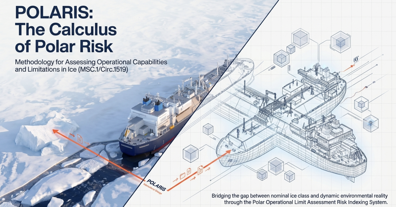
Building a Sea-Ice Risk Index: A Guide to the POLARIS System & RIO Calculation
Building a Sea-Ice Risk Index? Learn how to implement the POLARIS System and calculate the Risk Index Outcome (RIO) to automate maritime safety compliance. Navigating the Arctic isn’t just about steering a ship; it is a high-stakes calculus of physics, economics, and survival. As the polar ice caps recede and new shipping routes open, the…
Written by
-
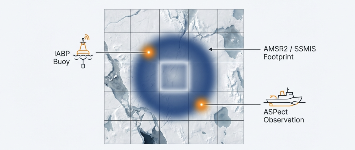
Quality Control at Scale: A Complete Guide to Validating Operational Sea-Ice Products
Validating operational sea-ice products requires more than visual checks. Discover the technical pipeline: Lagrangian drift matching, IIEE metrics, and Python automation for trusted Arctic data. If your operational sea-ice product misplaces the ice edge by 20 kilometers, it’s not just a statistical error—it is a navigational hazard and a logistical nightmare. For maritime logistics providers…
Written by
-
Mastering Sentinel-1 SAR Processing: A Step-by-Step Guide for Navigable Sea-Ice Maps (2025)
Master the Sentinel-1 SAR processing chain for accurate sea-ice maps. Learn the essential steps: Calibration, Lee Speckle Filtering, and Terrain Correction to fix raw data errors.” Critique: A bit dry. Refined (High CTR): “Is your SAR data too noisy? Master the Sentinel-1 SAR Processing chain. From Calibration to Lee Filtering—here is how to turn raw…
Written by
-
From Raw Swath to Arctic Map: Building a Satellite Data Processing Pipeline (End-to-End Guide)
Master Geospatial Data Engineering with this guide on building a Satellite Data Processing Pipeline. Learn to convert Raw Swath to Gridded Data for Arctic maps using Python, PyResample, and Cloud-Native Geospatial tools. Processing raw satellite data is often like trying to drink from a firehose. You are dealt terabytes of unprojected, messy “swath” data that…
Written by
