Tag: Northern Sea Route
-
Reinforcement Learning for Arctic Navigation: How AI Cracks the Ice Code (RouteView Analysis)
Discover how Reinforcement Learning Arctic Navigation is transforming global logistics. We analyze the RouteView architecture, Deep Q-Networks, and how AI saves 20% on fuel by “cracking” the ice code. The melting Arctic is opening the world’s most lucrative shortcut. The Northern Sea Route (NSR) and Northeast Passage (NEP) promise to slash voyage distances between Northern…
Written by

-
From Pixels to Paths: How to Implement Shortest Path Algorithms on Sea-Ice Raster Data
Unlock Arctic trade routes by converting Sea-Ice GeoTIFFs into routable network graphs. Learn the Python pipeline for POLARIS risk modeling, A* pathfinding, and handling 16-million-node grids. The “Shortest Path” Fallacy in Polar Navigation In standard logistics, the shortest distance between two points is a straight line. In the Arctic, a straight line is a disaster…
Written by

-
Building Smart Routing Engines: How to Encode Ice Class and Draft Limits
Master Maritime Routing Algorithm Optimization with this engineering guide. Learn to encode S-102 bathymetry, Dynamic Squat, and POLARIS Ice Risk into your Python pathfinding engine to prevent costly groundings. If you think the “Traveling Salesman Problem” is hard, try solving it on a surface that moves, freezes, and occasionally disappears. Maritime routing isn’t just about…
Written by

-
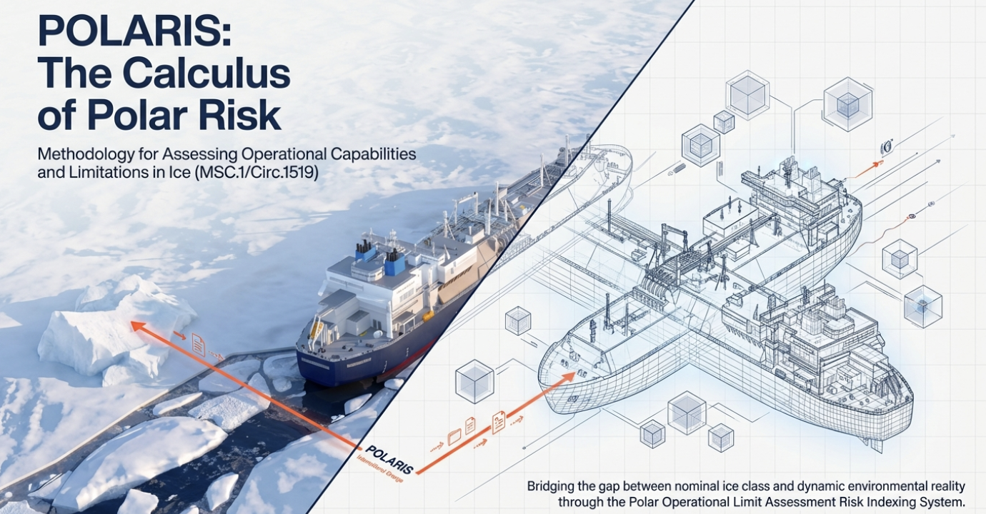
Building a Sea-Ice Risk Index: A Guide to the POLARIS System & RIO Calculation
Building a Sea-Ice Risk Index? Learn how to implement the POLARIS System and calculate the Risk Index Outcome (RIO) to automate maritime safety compliance. Navigating the Arctic isn’t just about steering a ship; it is a high-stakes calculus of physics, economics, and survival. As the polar ice caps recede and new shipping routes open, the…
Written by
-
Why Your Sea-Ice Map is Late: The Critical Role of Arctic Satellite Ground Stations
Why are your sea-ice maps delayed? Discover the critical role of Arctic Satellite Ground Stations like SvalSat. Learn how polar infrastructure cuts data latency and prevents maritime disasters. Imagine navigating an icebreaker through the Northern Sea Route. You are relying on a satellite ice chart to identify a safe path through a field of shifting…
Written by

-
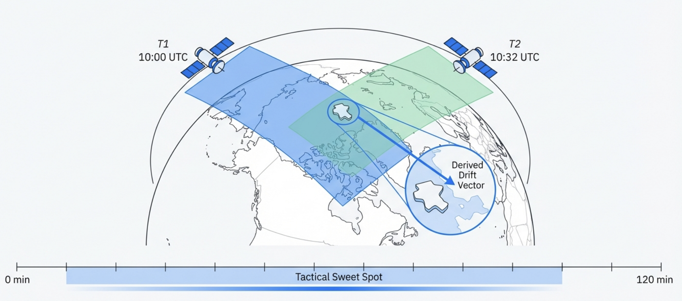
Beyond Static Maps: How Swath-to-Swath Sea-Ice Drift Estimation Saves Ships
Stop relying on static ice maps. Discover how Swath-to-Swath Sea-Ice Drift Estimation uses satellite overlap and algorithms like MCC to predict closing leads and save ships from the ‘Ice Trap’. The Arctic is not what it used to be. Decadal observations show that ice drift speeds have increased by approximately 20%. For a polar navigator,…
Written by
-
Can Satellites Really Measure Sea Ice Thickness? CryoSat-2 vs. Operational Reality
Can satellites really measure sea ice thickness for ship routing? We analyze CryoSat-2 accuracy, the physics of altimetry, and why latency makes it dangerous for navigation. The characterization of sea ice thickness (SIT) is the “Holy Grail” of the polar climate system. It dictates the mass balance of the Arctic and serves as the primary…
Written by
-
Navigating the Freeze: A Guide to Sea-Ice Concentration Products & Limitations
Is your sea-ice chart lying? We expose the risks of High-Resolution Sea-Ice Concentration Data, the ‘3km Grid’ myth, and the summer melt trap every navigator must know. You are navigating the Barents Sea in late July. Your onboard display, fed by the latest satellite data, reports “0% Ice Concentration” in your sector. You push the…
Written by